Ground-station Marcs
Owner N5FXH
Waterfall
DopplerComparaison
PostProcessing
satellite NOAA_19
date 2021-04-12
time 17:56:00
duration 930
freq 1.371e+08
culm 73.2135
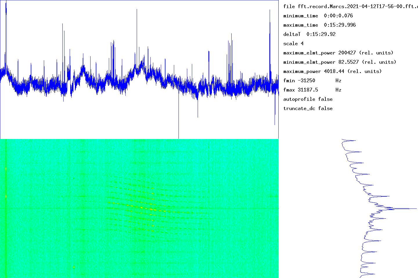
The graph at the bottom left gives the waterfall (time on the abscissa, frequency on the ordinate). The graph at the top gives the integrated signal strength in frequency as a function of time. At the bottom right, the average of the spectra over all the measurement times (frequency on the ordinate).
The time range of the measurement is given in the top right part (minimum_time, maximum_time). The frequency range determined by the number of points used by the Fourier transform is given by fmin and fmax. The units used for power (or the energy received in each time slot) could not be determined.
transitfile record.Marcs.2021-04-12T17-56-00.transit
The beginning of the transit is marked by a circle and the end of the transit by a disc.
![]()
When the intensity of the signal as a function of time follows an approximately Gaussian law, this tool must capture approximately the parameters by non-linear adjustment. The adjustment is carried out using the NLOPT2 library. The behavior is undefined if the law is arbitrary.
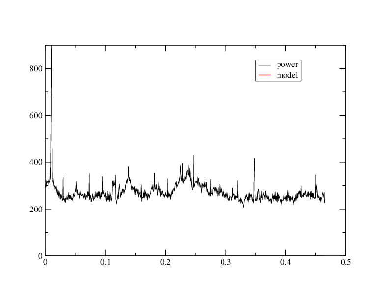
abscisses: giga-samples name ordinates: sum_20000(I2+Q2)/1e6
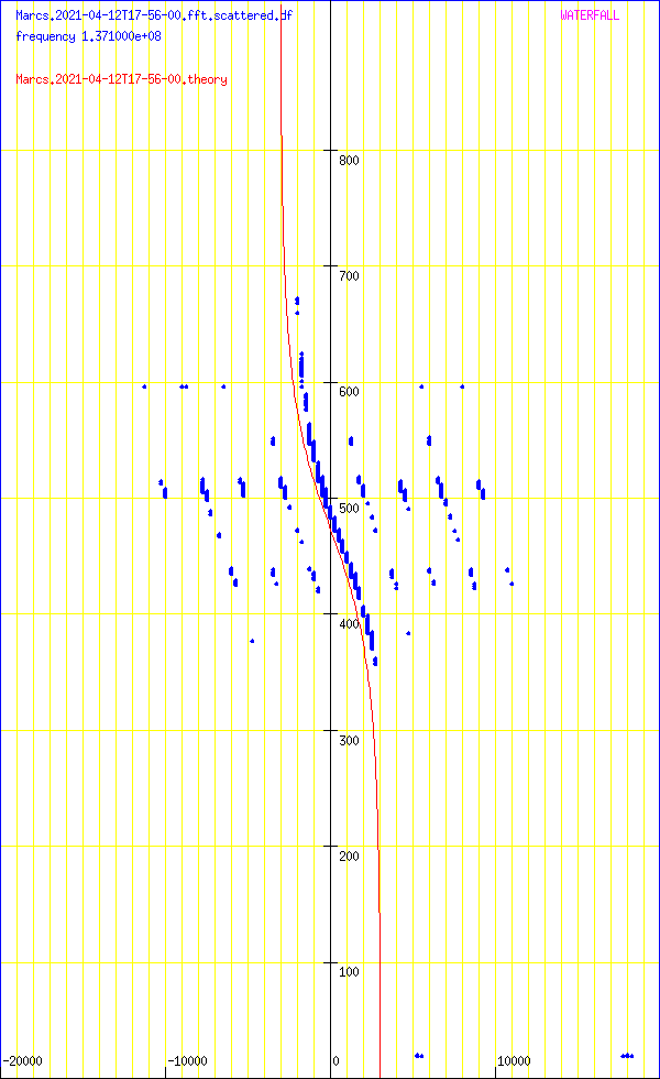
Abscissa: frequency in Hz
Ordinates: time in seconds
sumY2 1.36117e+12
sumDy2 1.27282e+12
dfmin 544.576 sumDy2 1.23322e+12
dtmin -0.91608 sumDy2 1.23316e+12
name ‘NOAA_19’
satellite_number 33591
central_object EARTH
ephemeris_type UnknownEphemerisType
epoch_year 21
epoch_day 101.82226793
Kepler elements
epoch_julday 2459316.32226793
Time jd 2459316.32227 < 2021-04-11 19:44:03.0949 UTC >
inclination 99.189 deg [99 11'20"]
right_ascension_of_ascending_node 120.86 deg [8:03:26]
major_radius 7229.92 km
eccentricity 0.0013241
periast_argument 322.618 deg [322 37'07"]
mean_anomaly 37.4063 deg [37 24'23"]
Supplemental data
cc 1.99735530184
ra 7.2395e+06 [868488]
rp 7.22035e+06 [849342]
va 7436.2
vp 7416.53
axb 7239.5 x 7239.49
mammmdt 325.916
bstar 0.8141
mean_motion_1st_deriv 4.2e-07
mean_motion_2nd_deriv 0
mean_motion 14.1246 rev/day 0.0707985 day/rev
periapsis_distance 7220.35 km
apoapsis_distance 7239.5 km
periapsis_mean_height 849.342 km
apoapsis_mean_height 868.488 km
rev_number_at_epoch 62751
tle_age 0.724341 day
NOAA 19
1 33591U 09005A 21101.82226793 .00000042 00000-0 48141-4 0 9997
2 33591 99.1890 120.8599 0013241 322.6185 37.4063 14.12459783627519
median 30.2576
noise_level_db 30.3586
min 19.1673
max 53.0196
freq_center -13877.7
trig_level_db 10
nbin_rescaling 29.9957
freq_center_trig -18204.8
signal_range_dB 22.6609
theo_range_dB 48.1648 [ 8 bits ]
Carte meteo WXTOIMG RESTORED v.2.10.11 https://wxtoimgrestored.xyz/
N5FXH’s page