
Ground-station Marcs
Owner N5FXH
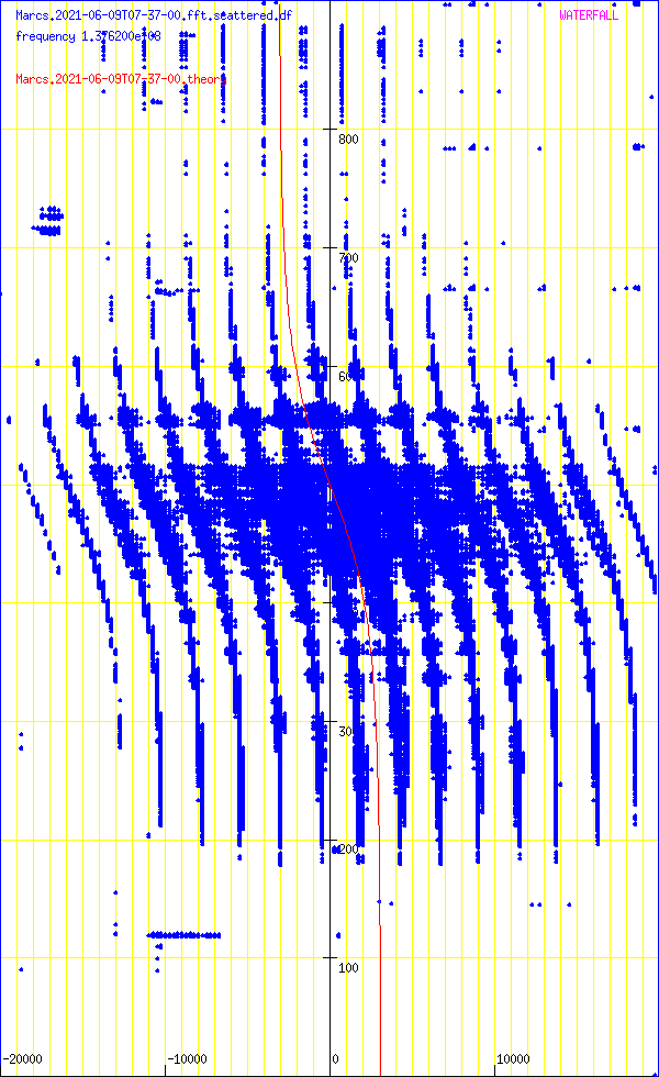
Waterfall
DopplerComparaison
PostProcessing
satellite NOAA_15
date 2021-06-09
time 07:37:00
duration 910
freq 1.3762e+08
culm 76.6827
The graph at the bottom left gives the waterfall (time on the abscissa, frequency on the ordinate). The graph at the top gives the integrated signal strength in frequency as a function of time. At the bottom right, the average of the spectra over all the measurement times (frequency on the ordinate).
The time range of the measurement is given in the top right part (minimum_time, maximum_time). The frequency range determined by the number of points used by the Fourier transform is given by fmin and fmax. The units used for power (or the energy received in each time slot) could not be determined.
transitfile record.Marcs.2021-06-09T07-37-00.transit
The beginning of the transit is marked by a circle and the end of the transit by a disc.
![]()
When the intensity of the signal as a function of time follows an approximately Gaussian law, this tool must capture approximately the parameters by non-linear adjustment. The adjustment is carried out using the NLOPT2 library. The behavior is undefined if the law is arbitrary.

abscisses: giga-samples name ordinates: sum_20000(I2+Q2)/1e6
Abscissa: frequency in Hz
Ordinates: time in seconds
sumY2 7.05771e+14
sumDy2 6.8134e+14
dfmin -145.895 sumDy2 6.8077e+14
dtmin 5.42039 sumDy2 6.8045e+14
name ‘NOAA_15’
satellite_number 25338
central_object EARTH
ephemeris_type UnknownEphemerisType
epoch_year 21
epoch_day 159.10477901
Kepler elements
epoch_julday 2459373.60477901
Time jd 2459373.60478 < 2021-06-08 02:30:52.0906 UTC >
inclination 98.682 deg [98 40'55"]
right_ascension_of_ascending_node 187.713 deg [12:30:51]
major_radius 7183.96 km
eccentricity 0.0009414
periast_argument 312.521 deg [312 31'15"]
mean_anomaly 47.5175 deg [47 31'03"]
Supplemental data
cc 1.9981189708
ra 7.19073e+06 [819719]
rp 7.1772e+06 [806193]
va 7457.09
vp 7443.06
axb 7190.73 x 7190.72
mammmdt 86.86
bstar 0.3576
mean_motion_1st_deriv 8.4e-07
mean_motion_2nd_deriv 0
mean_motion 14.2604 rev/day 0.0701245 day/rev
periapsis_distance 7177.2 km
apoapsis_distance 7190.73 km
periapsis_mean_height 806.193 km
apoapsis_mean_height 819.719 km
rev_number_at_epoch 19991
tle_age 0.632131 day
NOAA 15
1 25338U 98030A 21159.10477901 .00000084 00000-0 53576-4 0 9990
2 25338 98.6820 187.7134 0009414 312.5209 47.5175 14.26035553199919
median 22.1595
noise_level_db 21.8163
min 10.6104
max 57.2485
freq_center -22190.6
trig_level_db 10
nbin_rescaling 29.9957
freq_center_trig -2989.73
signal_range_dB 35.4322
theo_range_dB 48.1648 [ 8 bits ]
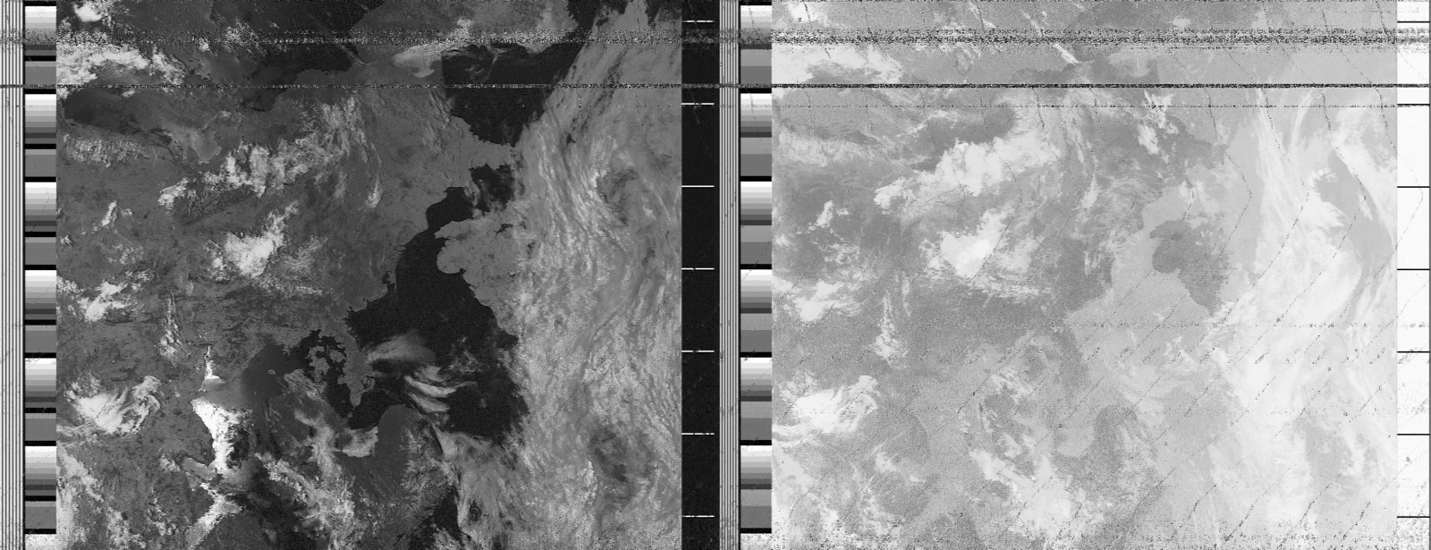
Carte meteo WXTOIMG RESTORED v.2.10.11 https://wxtoimgrestored.xyz/
N5FXH’s page