Ground-station Satnogs-VHF
Owner N5CNB
Waterfall
DopplerComparaison
PostProcessing
satellite NOAA_19
date 2021-04-18
time 13:51:00
duration 630
freq 1.371e+08
culm 50.1301
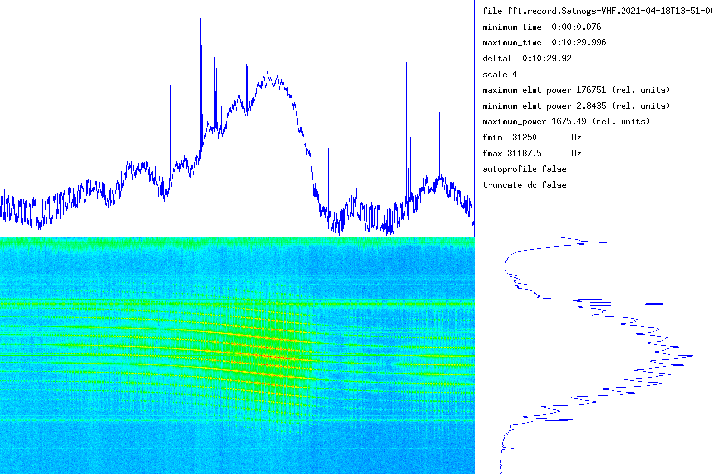
The graph at the bottom left gives the waterfall (time on the abscissa, frequency on the ordinate). The graph at the top gives the integrated signal strength in frequency as a function of time. At the bottom right, the average of the spectra over all the measurement times (frequency on the ordinate).
The time range of the measurement is given in the top right part (minimum_time, maximum_time). The frequency range determined by the number of points used by the Fourier transform is given by fmin and fmax. The units used for power (or the energy received in each time slot) could not be determined.
transitfile record.Satnogs-VHF.2021-04-18T13-51-00.transit
The beginning of the transit is marked by a circle and the end of the transit by a disc.
![]()
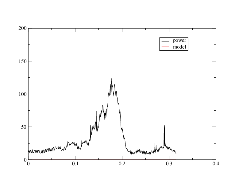
When the intensity of the signal as a function of time follows an approximately Gaussian law, this tool must capture approximately the parameters by non-linear adjustment. The adjustment is carried out using the NLOPT2 library. The behavior is undefined if the law is arbitrary.
abscisses: giga-samples name ordinates: sum_20000(I2+Q2)/1e6
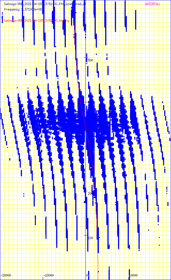
Abscissa: frequency in Hz
Ordinates: time in seconds
sumY2 4.74331e+14
sumDy2 4.60769e+14
dfmin 144.508 sumDy2 4.60401e+14
dtmin 1.9309 sumDy2 4.60381e+14
name ‘NOAA_19’
satellite_number 33591
central_object EARTH
ephemeris_type UnknownEphemerisType
epoch_year 21
epoch_day 107.13507551
Kepler elements
epoch_julday 2459321.63507551
Time jd 2459321.63508 < 2021-04-17 03:14:30.0524 UTC >
inclination 99.1886 deg [99 11'19"]
right_ascension_of_ascending_node 126.307 deg [8:25:14]
major_radius 7229.92 km
eccentricity 0.0013072
periast_argument 306.847 deg [306 50'50"]
mean_anomaly 53.1499 deg [53 09'00"]
Supplemental data
cc 1.99738901308
ra 7.23937e+06 [868363]
rp 7.22047e+06 [849461]
va 7436.07
vp 7416.66
axb 7239.37 x 7239.36
mammmdt 326.404
bstar 0.6008
mean_motion_1st_deriv 3.8e-07
mean_motion_2nd_deriv 0
mean_motion 14.1246 rev/day 0.0707984 day/rev
periapsis_distance 7220.47 km
apoapsis_distance 7239.37 km
periapsis_mean_height 849.461 km
apoapsis_mean_height 868.363 km
rev_number_at_epoch 62826
tle_age 0.576348 day
NOAA 19
1 33591U 09005A 21107.13507551 .00000038 00000-0 46008-4 0 9996
2 33591 99.1886 126.3072 0013072 306.8473 53.1499 14.12460815628266
median 13.5354
noise_level_db 13.5569
min 4.53854
max 52.4736
freq_center 9572.53
trig_level_db 10
nbin_rescaling 29.9957
freq_center_trig 5212.96
signal_range_dB 38.9168
theo_range_dB 48.1648 [ 8 bits ]
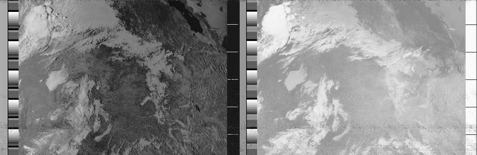
Carte meteo WXTOIMG RESTORED v.2.10.11 https://wxtoimgrestored.xyz/
N5FXH’s page