Ground-station Satnogs-VHF
Owner N5CNB
Waterfall
DopplerComparaison
PostProcessing
satellite NOAA_19
date 2021-06-09
time 01:15:00
duration 630
freq 1.371e+08
culm 51.634
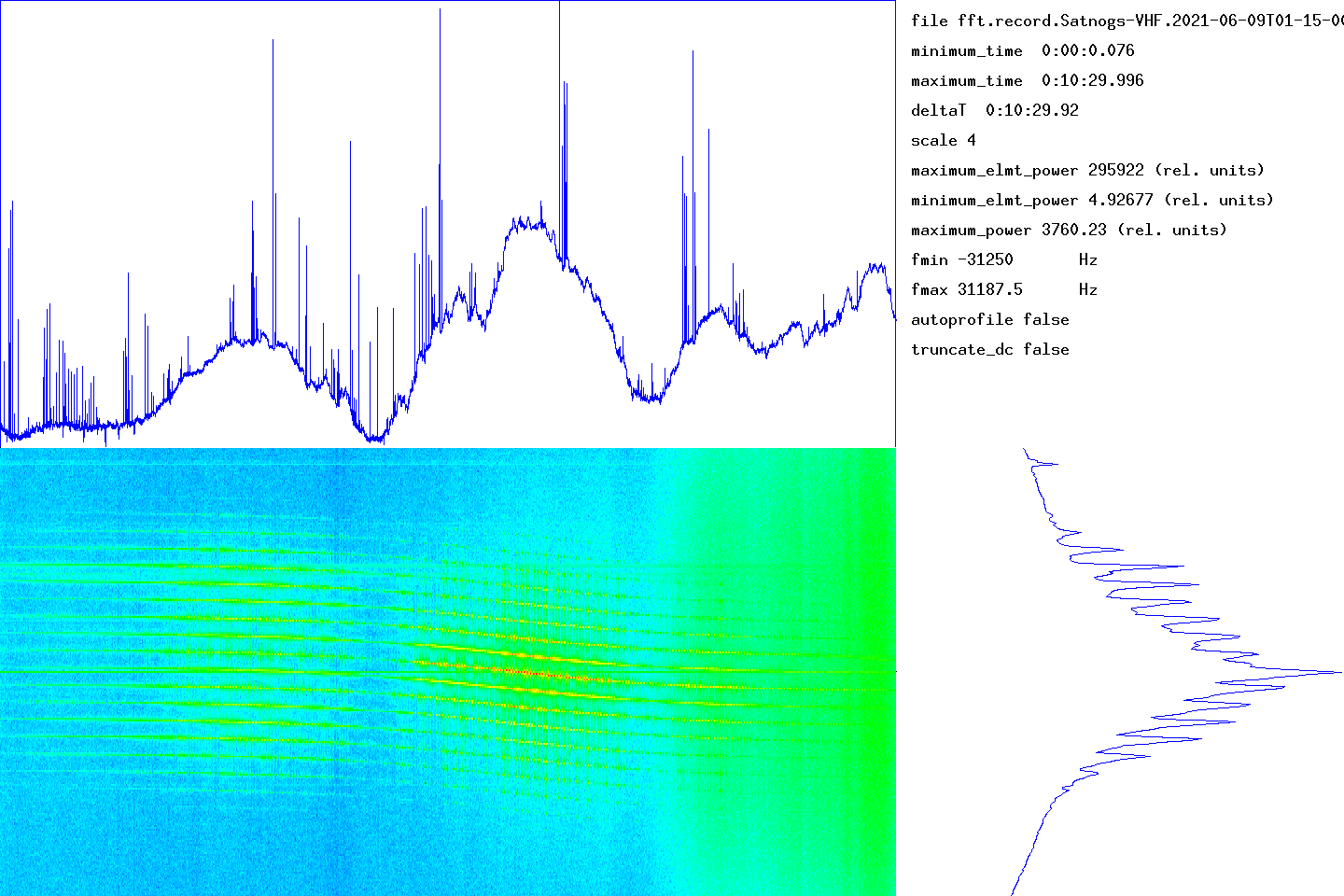
The graph at the bottom left gives the waterfall (time on the abscissa, frequency on the ordinate). The graph at the top gives the integrated signal strength in frequency as a function of time. At the bottom right, the average of the spectra over all the measurement times (frequency on the ordinate).
The time range of the measurement is given in the top right part (minimum_time, maximum_time). The frequency range determined by the number of points used by the Fourier transform is given by fmin and fmax. The units used for power (or the energy received in each time slot) could not be determined.
transitfile record.Satnogs-VHF.2021-06-09T01-15-00.transit
The beginning of the transit is marked by a circle and the end of the transit by a disc.
![]()
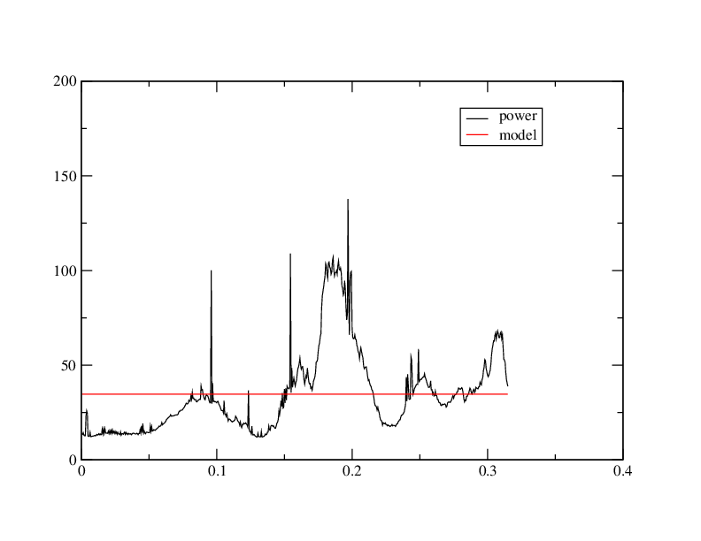
When the intensity of the signal as a function of time follows an approximately Gaussian law, this tool must capture approximately the parameters by non-linear adjustment. The adjustment is carried out using the NLOPT2 library. The behavior is undefined if the law is arbitrary.
abscisses: giga-samples name ordinates: sum_20000(I2+Q2)/1e6
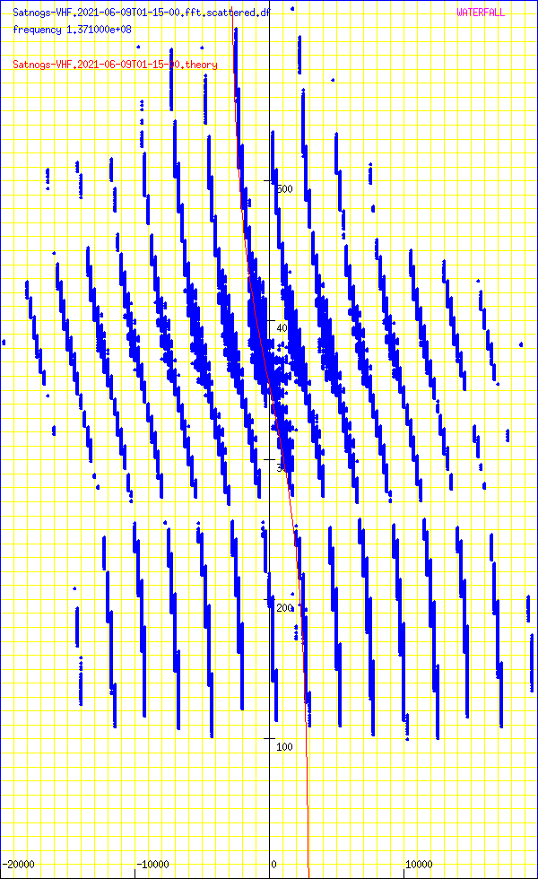
Abscissa: frequency in Hz
Ordinates: time in seconds
sumY2 9.74689e+13
sumDy2 9.78206e+13
dfmin 156.932 sumDy2 9.76957e+13
dtmin 9.56205 sumDy2 9.75553e+13
name ‘NOAA_19’
satellite_number 33591
central_object EARTH
ephemeris_type UnknownEphemerisType
epoch_year 21
epoch_day 159.05877398
Kepler elements
epoch_julday 2459373.55877398
Time jd 2459373.55877 < 2021-06-08 01:24:38.0071 UTC >
inclination 99.1833 deg [99 11'00"]
right_ascension_of_ascending_node 179.532 deg [11:58:08]
major_radius 7229.88 km
eccentricity 0.0014399
periast_argument 155.051 deg [155 03'04"]
mean_anomaly 205.1359 deg [205 08'09"]
Supplemental data
cc 1.99712434066
ra 7.24029e+06 [869280]
rp 7.21947e+06 [848459]
va 7437.08
vp 7415.7
axb 7240.29 x 7240.28
mammmdt 326.629
bstar 0.839
mean_motion_1st_deriv 9.8e-07
mean_motion_2nd_deriv 0
mean_motion 14.1247 rev/day 0.0707978 day/rev
periapsis_distance 7219.47 km
apoapsis_distance 7240.29 km
periapsis_mean_height 848.459 km
apoapsis_mean_height 869.28 km
rev_number_at_epoch 63559
tle_age 0.678564 day
NOAA 19
1 33591U 09005A 21159.05877398 .00000098 00000-0 78390-4 0 9998
2 33591 99.1833 179.5319 0014399 155.0510 205.1359 14.12473177635594
median 16.3314
noise_level_db 16.2922
min 6.92562
max 54.7118
freq_center 2581.39
trig_level_db 10
nbin_rescaling 29.9957
freq_center_trig 731.707
signal_range_dB 38.4196
theo_range_dB 48.1648 [ 8 bits ]
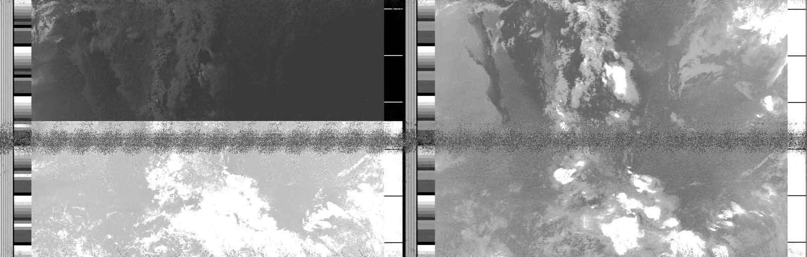
Carte meteo WXTOIMG RESTORED v.2.10.11 https://wxtoimgrestored.xyz/
N5FXH’s page